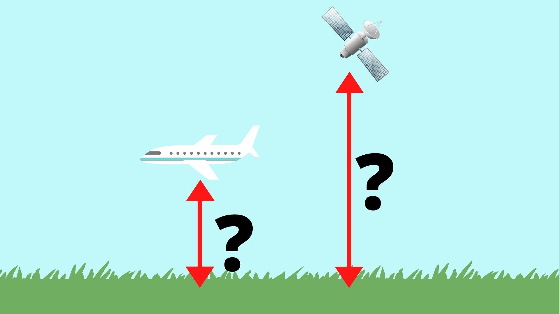
50, 40, 30, 20, 10…… You may have heard this on a flight simulation when the simulated aircraft is landing. Or you might have seen the Mars landing footage of the Perseverance rover (click the link if you haven’t watched this). Well, we have to precisely measure the altitude to conduct these actions successfully. Here’s an introduction to the method and tools used for these measurements.
Altimeters
For an aircraft, we use altimeters. It’s an instrument to measure how high it is. With an introduction that’s as brief as this, you’ll probably ask, “How does an altimeter work?” Therefore, let’s answer this question in the following paragraphs. (National Geographic, 2014).
To understand how altimeters work, we must first learn about gravity. As you all know, gravity is the force pulling things downward. This force holds the atmosphere from escaping into space and keeps Earth near the Sun so that the right temperature can be continuously maintained. Therefore, the air is denser near the ground since most air is pushed downward while very little air is floating up in the thermosphere. (National Physical Laboratory, n.d.). In fact, about 75% of the atmosphere’s mass is in the troposphere, which is the innermost layer of the atmosphere. (NASA Space Place, 2019).
As a result, it is possible to measure your altitude using air pressure as it is calculable when considering gravity and the atmospheric pressure at sea level. An altimeter that uses this method contains a barometer used to sense the air pressure to obtain altitude data.
This type of altimeters are generally useful on Earth. But what about other scenarios where there’s no atmosphere or the sensor isn’t exposed to air? In that case, we need to use other methods to know how high the object is.
Using Light
If you want to measure altitude when there’s no air around you, you may need to get a bit more creative. We have to use light waves, and we call the instruments laser altimeters or radar altimeters.
The instrument consists of an emitter that emits some electromagnetic radiation, a receiver that looks for the signal, and a very precise timer to get the exact round-trip time. Then, the onboard computer will multiply the time by the speed of light to obtain the distance the light wave has traveled between the emitter and the receiver, and just divide the result by two to get the distance of the aircraft/spacecraft to the ground. (P. Falkner, R. Schulz, 2015).
For instance, if it takes 0.00267 seconds for light to go from the spacecraft to the ground and back, its altitude is 0.00267 * 299792458 / 2. That’s about 400 kilometers (400000 meters), which is the approximate altitude of the International Space Station! (Elizabeth Howell, 2018).
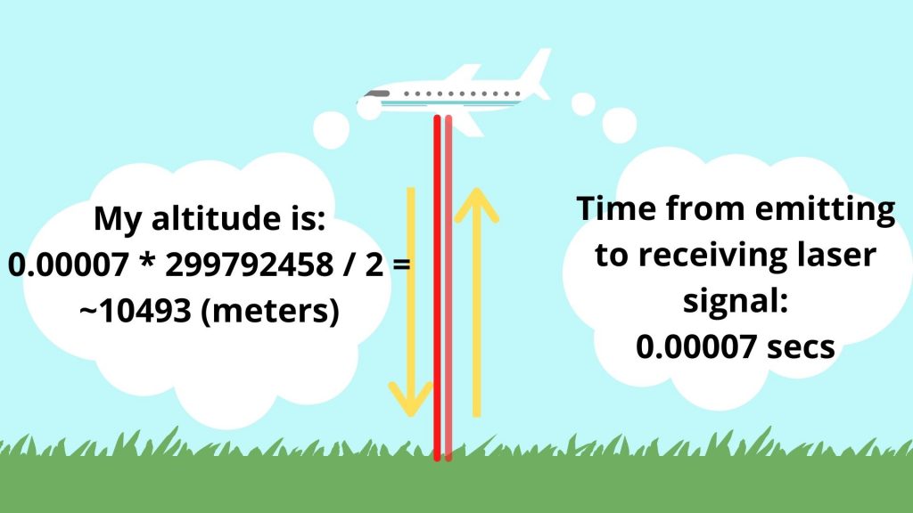
Image Credit: Canva
Other than altitude measurements, these altimeters provide essential data to know the effect of climate change. For instance, ICESat-2 uses a laser altimeter to measure the elevation of ice structures. (“Our Mission”, n.d.; “Space Lasers”, n.d.). Besides, the Sentinel-6 spacecraft uses a radar altimeter to obtain the rising sea level. (NASA Jet Propulsion Laboratory, n.d.).
Stereo Vision
Let’s say you put an object close to your eyes. Then, stare at it with your left eye. Now, stare at it with your right eye but don’t move your head. Can you see the difference? Well, that’s the thing that enables stereo vision to measure distance.

Note: Objects and angle of view are not to scale.
Image Credit: Canva
If there is a distance between the two cameras, they have a different view of the object. For altitude measurements, the object is the ground. If the two cameras are looking at the same object, they can use the difference in the object’s viewing angle to measure the distance to the target.
Why Should We Measure Altitude Precisely?
Well, if the aircraft or spacecraft is going to rendezvous with something or dodge dangerous obstacles, they need to measure their altitude correctly. For instance, the plane needs to maintain the correct altitude across its descent to touch down in the desired spot on the runway. Moreover, they need to follow the ATC’s instructions with precise altitude and speed measurements. If not, they could crash into something.
For space probes, it must be even more accurate. Consider deorbit burns. The crew needs to land at the right spot to ensure safety. Therefore, the burn need to take place at the right altitude and with the right deceleration to send it in an orbit to intercept Earth’s atmosphere at the right spot.
Conclusion
So, we’ve talked about using atmospheric pressure and light waves to measure the altitude of an aircraft or spacecraft. We’ve also discussed the importance of precise altitude measurements in the last section. To find out more, please visit the webpages in the references below.
References and Credits
- Amy Shira Teitel. (2011, November 18). Do-It-Yourself Guide to Measuring the Moon’s Distance. Retrieved April 18, 2021, from https://www.universetoday.com/91120/do-it-yourself-guide-to-measuring-the-moons-distance/
- Elizabeth Howell. (2018, February 8). International Space Station: Facts, History & Tracking. Retrieved April 18, 2021, from https://www.space.com/16748-international-space-station.html
- “Our Mission”. (n.d.). Retrieved April 18, 2021, from https://icesat-2.gsfc.nasa.gov/mission
- P. Falkner, R. Schulz. (2015). Laser Altimeter. Retrieved April 18, 2021, from https://www.sciencedirect.com/topics/earth-and-planetary-sciences/laser-altimeter
- NASA Jet Propulsion Laboratory. (n.d.). Sentinel-6 Launch Press Kit | Spacecraft and Instruments. Retrieved April 18, 2021, from https://www.jpl.nasa.gov/news/press_kits/sentinel-6/mission/spacecraft/
- NASA Space Place. (2019, June 28). Troposphere. Retrieved April 18, 2021, from https://spaceplace.nasa.gov/troposphere/
- National Geographic. (2014, June 23). Altimeter. Retrieved April 18, 2021, from https://www.nationalgeographic.org/encyclopedia/altimeter/
- National Physical Laboratory. (n.d.). Why does atmospheric pressure change with altitude? Retrieved April 18, 2021, from https://www.npl.co.uk/resources/q-a/atmospheric-altitude-pressure-changes
- “Space Lasers”. (n.d.). Retrieved April 18, 2021, from https://icesat-2.gsfc.nasa.gov/space-lasers